Ten of Toronto
What do ten neighbourhoods tell us about who we are?
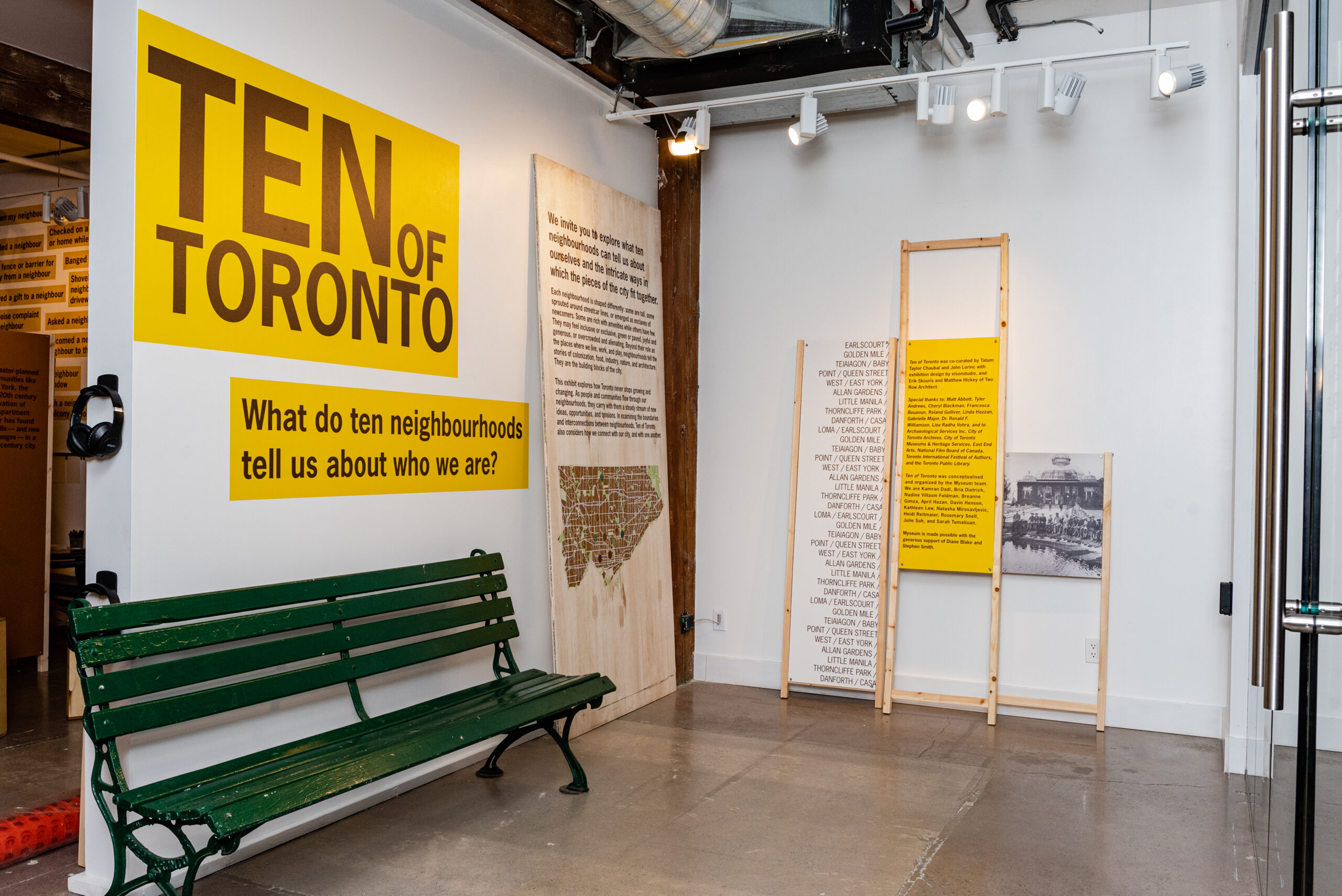
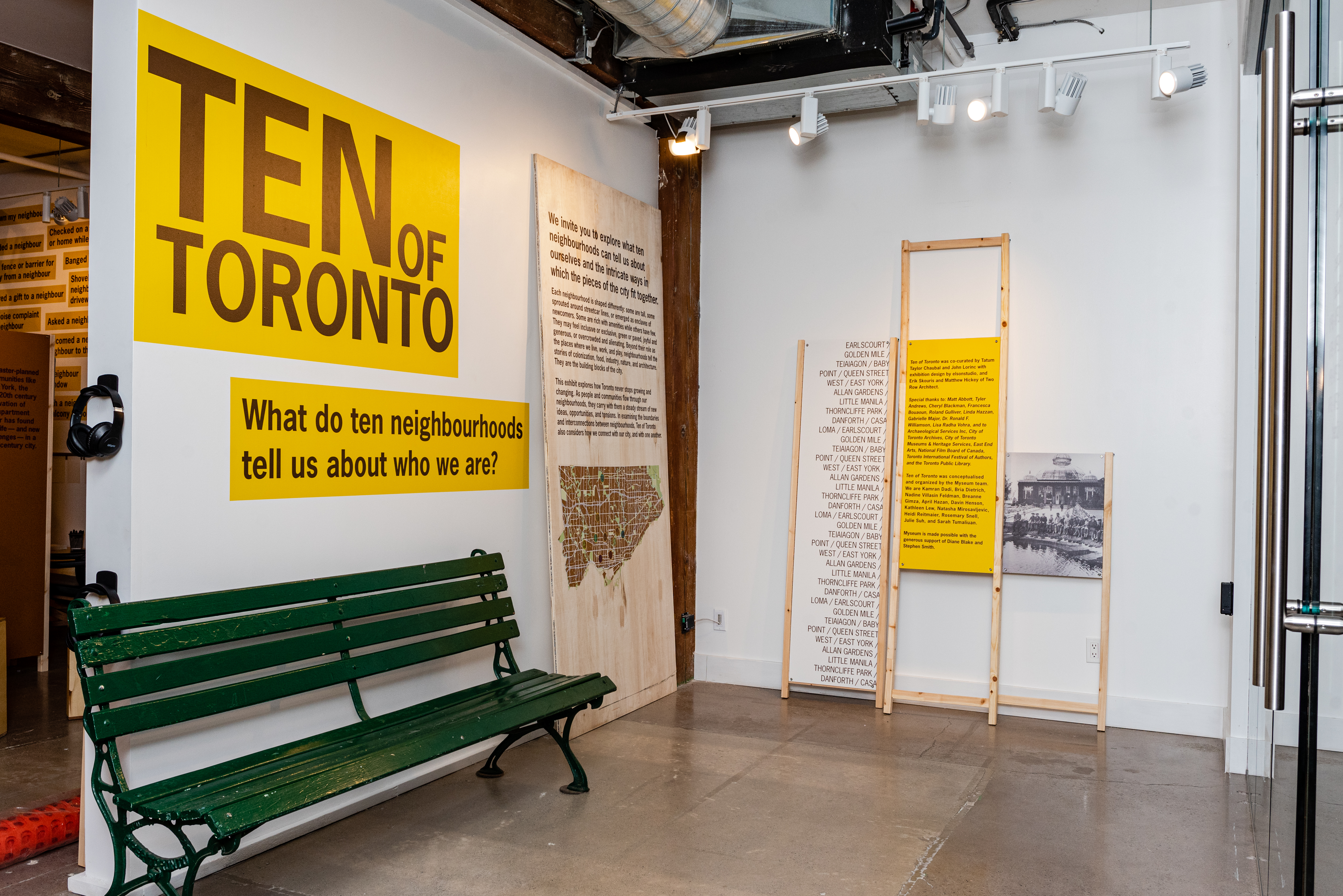
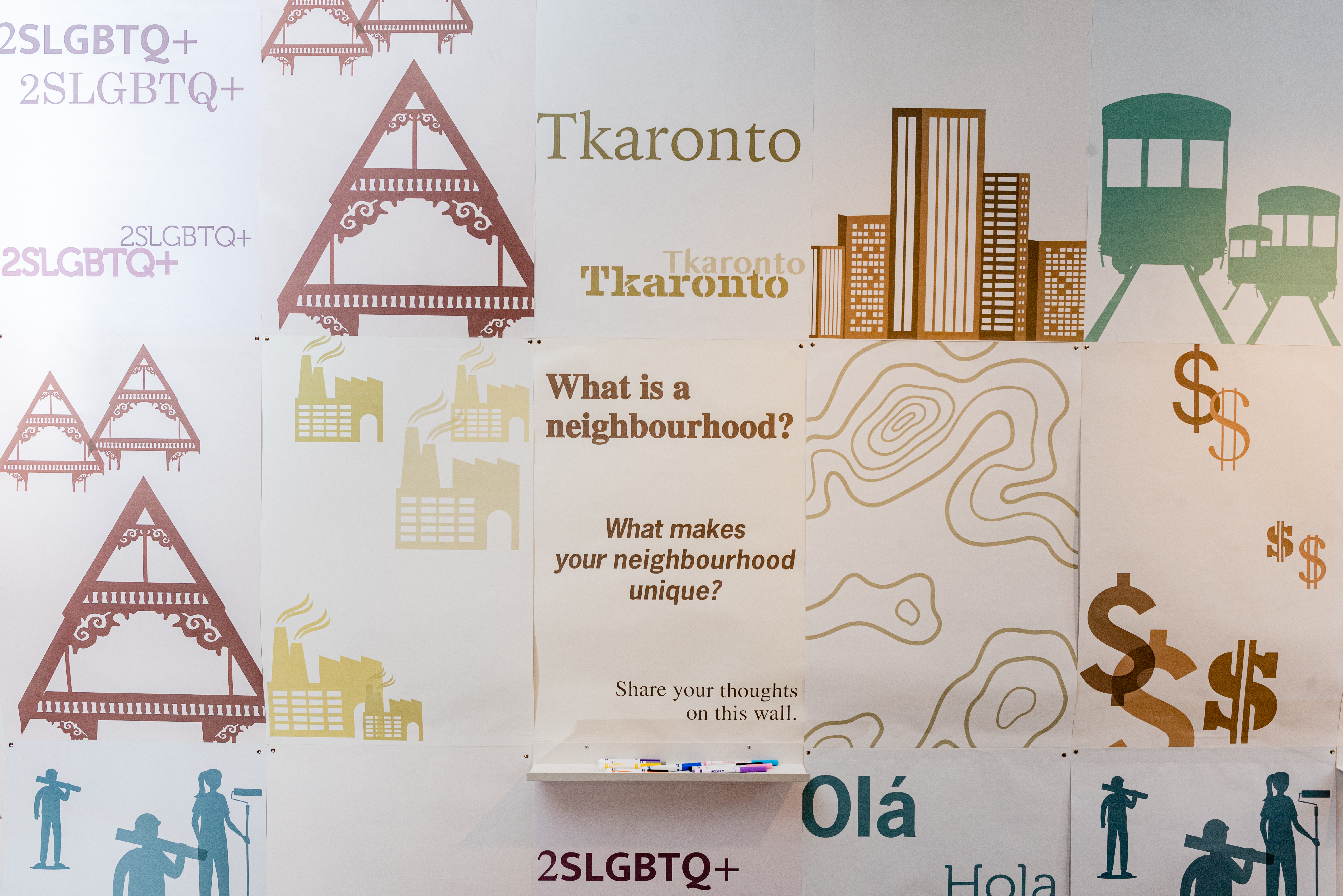
This exhibition explored what ten neighbourhoods can tell us about ourselves and the intricate ways in which the pieces of the city fit together.
Each neighbourhood is shaped differently: some are tall, some sprouted around streetcar lines, or emerged as enclaves of newcomers. Some are rich with amenities while others have few. They may feel inclusive or exclusive, green or paved, joyful and generous, or overcrowded and alienating. Beyond their role as the places where we live, work, and play, neighbourhoods tell the stories of colonization, food, industry, nature, and architecture. They are the building blocks of the city.
This exhibition explored how Toronto never stops growing and changing. As people and communities flow through our neighbourhoods, they carry with them a steady stream of new ideas, opportunities, and tensions. In examining the boundaries and interconnections between neighbourhoods, Ten of Toronto also considers how we connect with our city, and with one another.
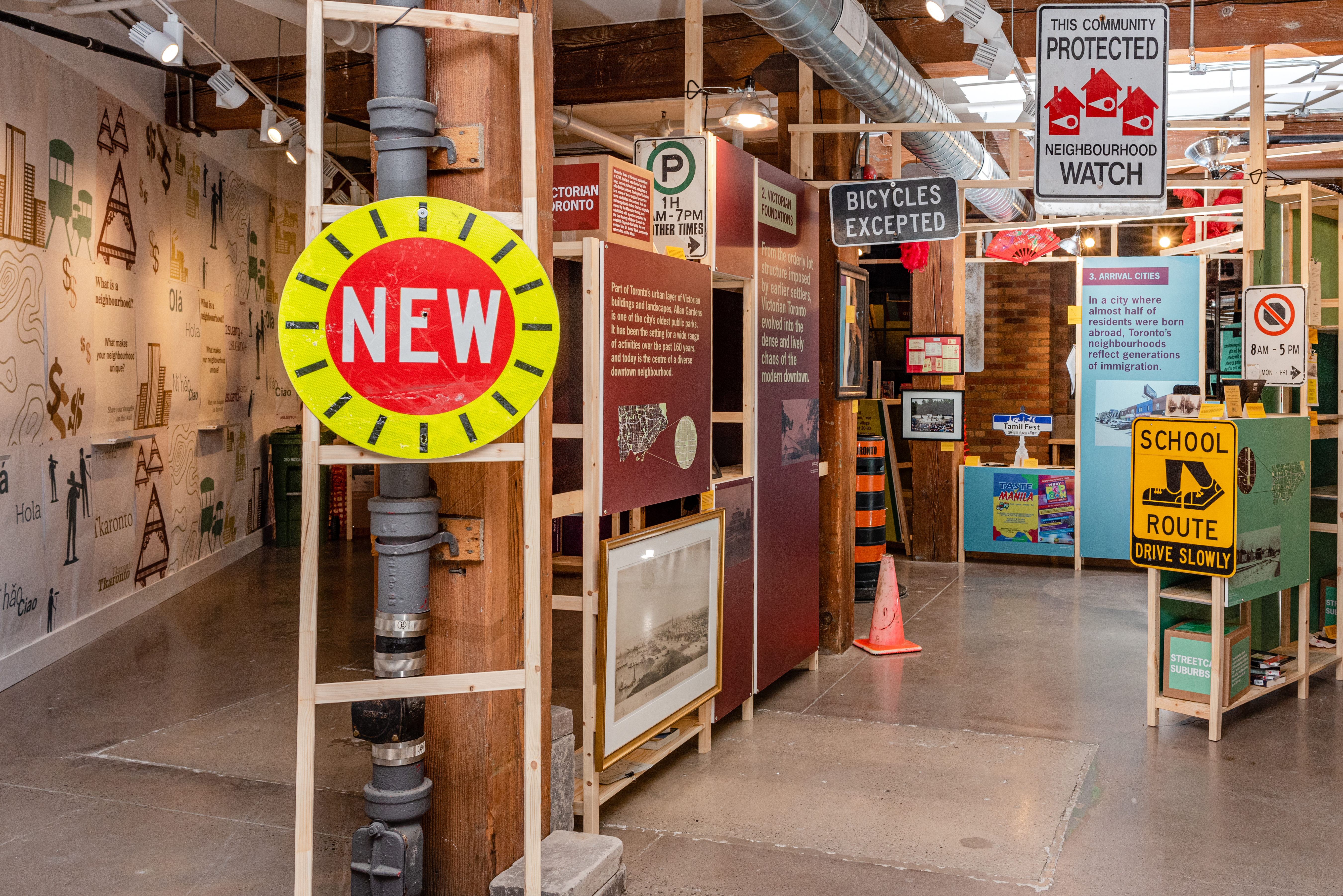
Ten of Toronto
Digital Collection
Exhibition
Explorer
Wychwood Barn
This is the story of Toronto’s Wychwood Barns community hub and the history of Streetcar Suburbs.
Wychwood Barn
Video
• :59
Workers Housing
Quick Facts
Toronto’s annual average income (2016): $52,268
Here are the average incomes of Toronto’s wealthiest neigbhourhoods:
- Casa Loma: $165,047
- Rosedale/Moore Park: $207,903
- Forest Hill South: $204,521
- Bridle Path/Sunnybrook-York Mills: $308,010
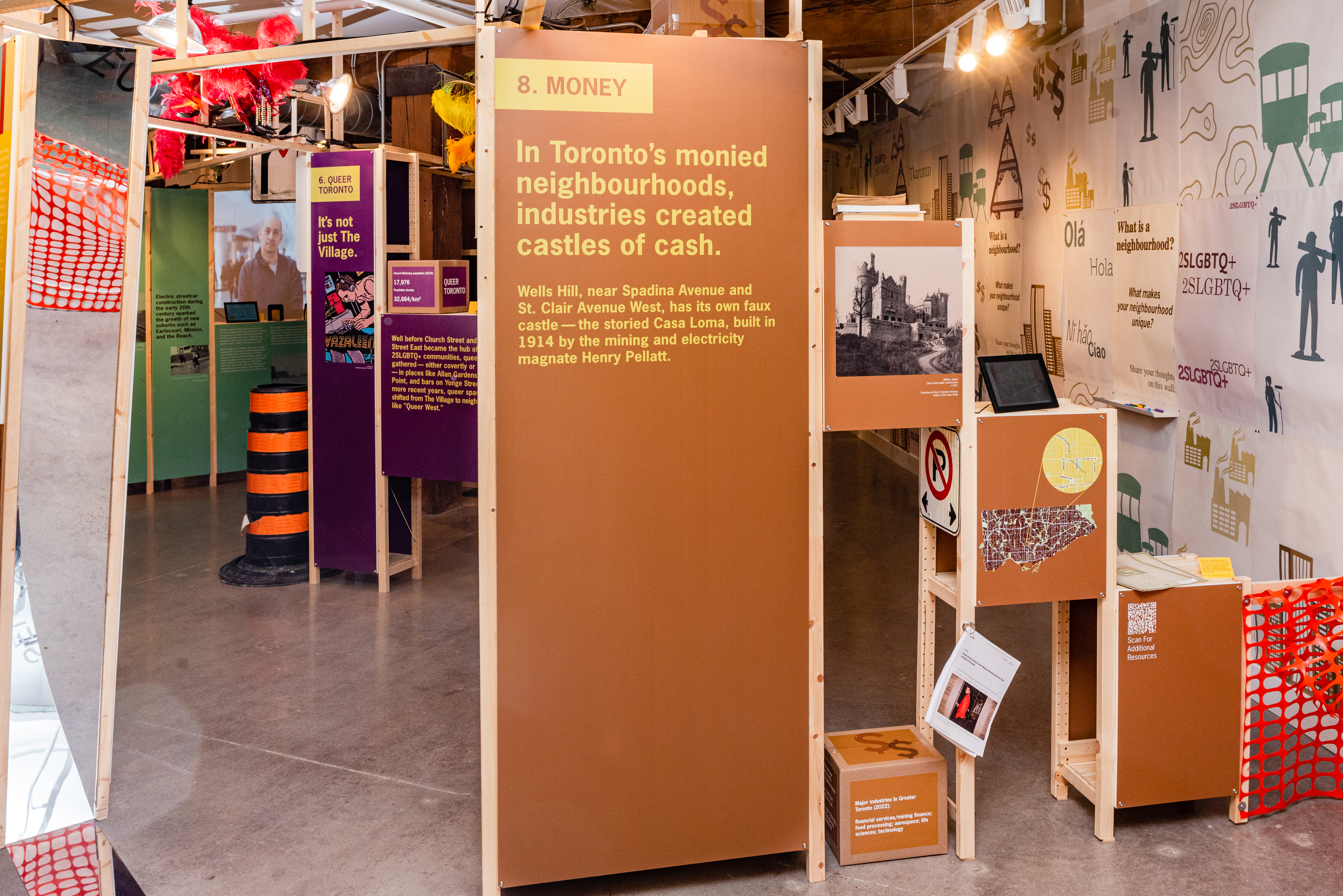
Major industries in Greater Toronto (2022): financial services/mining finance; food processing; aerospace; life sciences; technology.
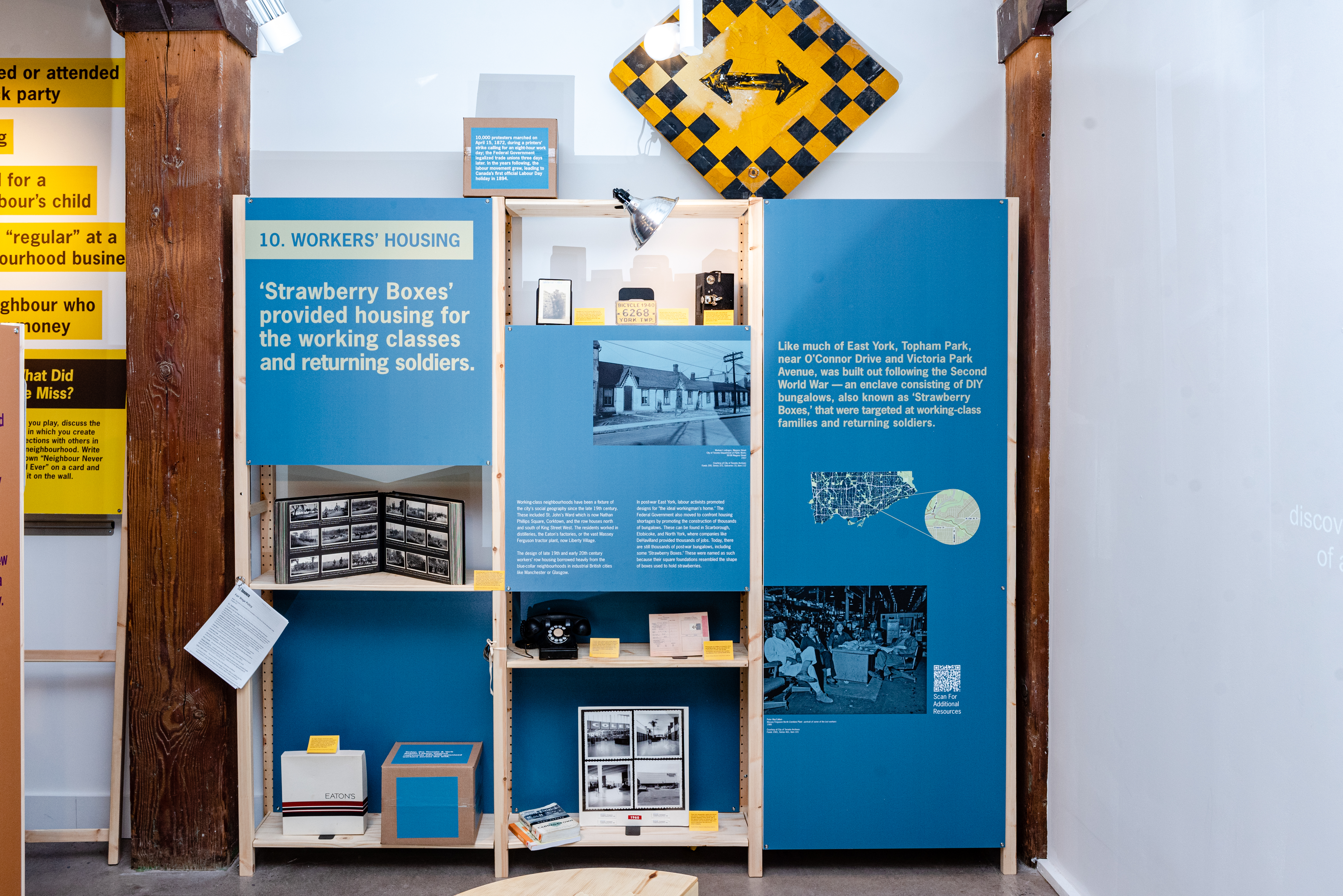
‘Strawberry Boxes’ provided housing for the working classes and returning soldiers. Working class neighbourhoods have been a fixture of the city’s social geography since the late 19th century. These included St. John’s Ward, now City Hall/Nathan Phillips Square, Corktown, now the Distillery District, and the row houses north and south of King Street West. The residents worked in distilleries, the Eaton’s factories, or the vast Massey Ferguson plant, now Liberty Village.
The design of late 19th and early 20th century workers’ row housing borrowed heavily from the blue-collar neighbourhoods in industrial British cities like Manchester or Glasgow.
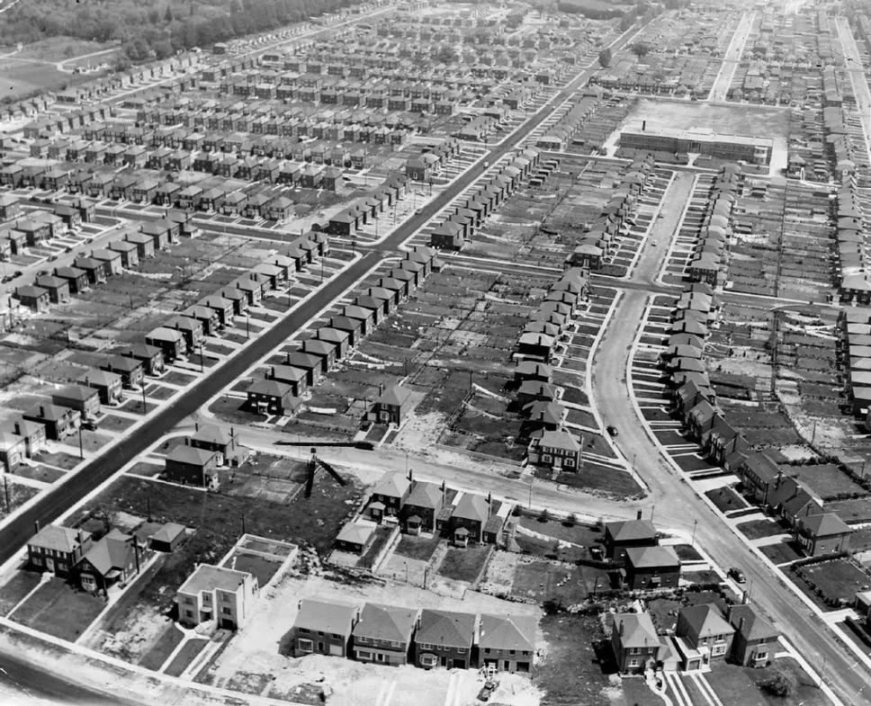
In post-war East York, labour activists promoted designs for “the ideal workingman’s home.” The Federal Government also moved to confront housing shortages by promoting the construction of thousands of bungalows. These can be found in Scarborough, Etobicoke, and North York, where companies like DeHavilland provided thousands of jobs. Today, there are still thousands of post-war bungalows, including some ‘Strawberry Boxes.’ These were named as such because their square foundations resembled the shape of boxes used to hold strawberries.
Like much of East York, Topham Park, near O’Connor Drive and Victoria Park Avenue, was built out following the Second World War — an enclave consisting of DIY bungalows, also known as ‘Strawberry Boxes,’ that were targeted at working class families and returning soldiers.
Workers Housing
Article
Victorian Foundations
Quick Facts
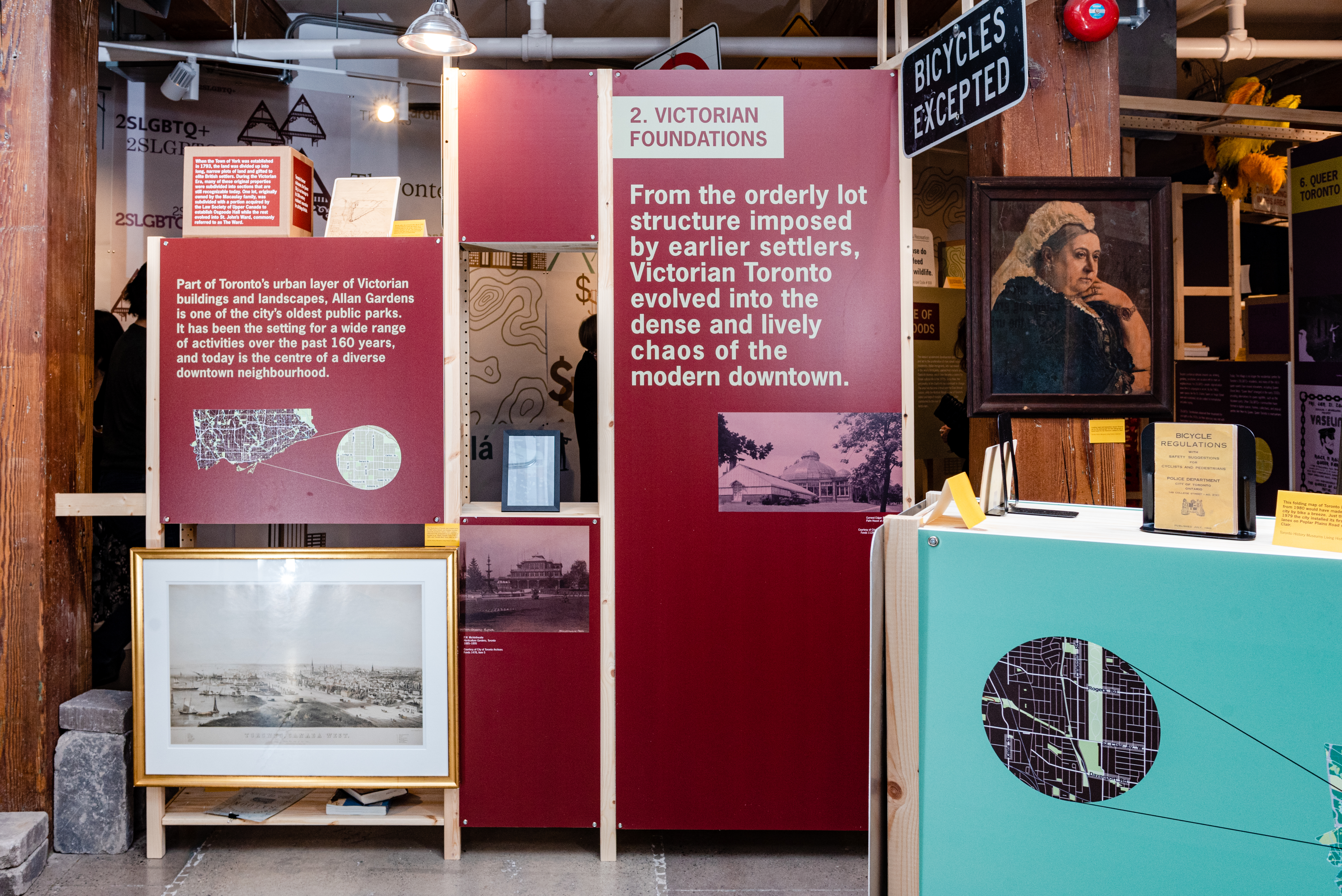
When the Town of York was established in 1793, the land was divided up into long, narrow plots of land and gifted to elite British settlers. During the Victorian Era, many of these original properties were subdivided into sections that are still recognizable today. One lot, originally owned by the Macaulay family, was subdivided with a portion acquired by the Law Society of Upper Canada to establish Osgoode Hall while the rest evolved into St. John’s Ward, commonly referred to as The Ward.
Toronto’s former nickname, the Queen City, is an homage to its 19th-century residents’ veneration for all things British.
A giant statue of Queen Victoria was once proposed as the focal point of a public square next to Old City Hall.
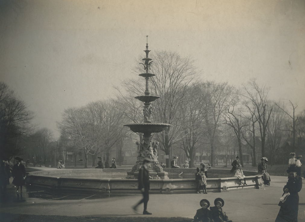
Part of Toronto’s urban layer of Victorian buildings and landscapes, Allan Gardens is one of the city’s oldest public parks. It has been the setting for a wide range of activities over the past 160 years, and today is the centre of a diverse downtown neighbourhood. From the orderly lot structure imposed by earlier settlers, Victorian Toronto evolved into the dense and lively chaos of the modern downtown.
When John Graves Simcoe established the Town of York in 1793, he divided Toronto into a series of long, narrow ‘Park Lots’ between Queen Street and Bloor Street and granted them to elite settlers. By the mid-19th century, they were subdividing the lots as the city expanded. Many of Toronto’s oldest buildings and landscapes date to the Victorian period between 1837–1901.
Merchant William Allan built a grand home called Moss Park on his Park Lot in 1827. After his death in the 1850s, his son George donated five acres to the Toronto Horticultural Society. This area bordered by Carlton, Sherbourne, Gerrard, and Jarvis became Allan Gardens, one of Toronto’s earliest public parks.
The Society opened a pavilion there in 1860 that has since been replaced. Allan Gardens served as a venue for floral displays, performances, and even a lecture by Oscar Wilde in 1882.
Over time, Allan Gardens evolved. The park was a gay cruising spot as early as the 1910s, a setting for free speech debates in the 1960s, and the site of G20 protests in 2010. Today, Allan Gardens is a botanical garden, a gathering place for 2SLGBTQ+ and Indigenous events, as well as an outdoor space for apartment dwellers and unhoused community members.
Victorian Foundations
Article
Tower Neighbourhoods
Quick Facts
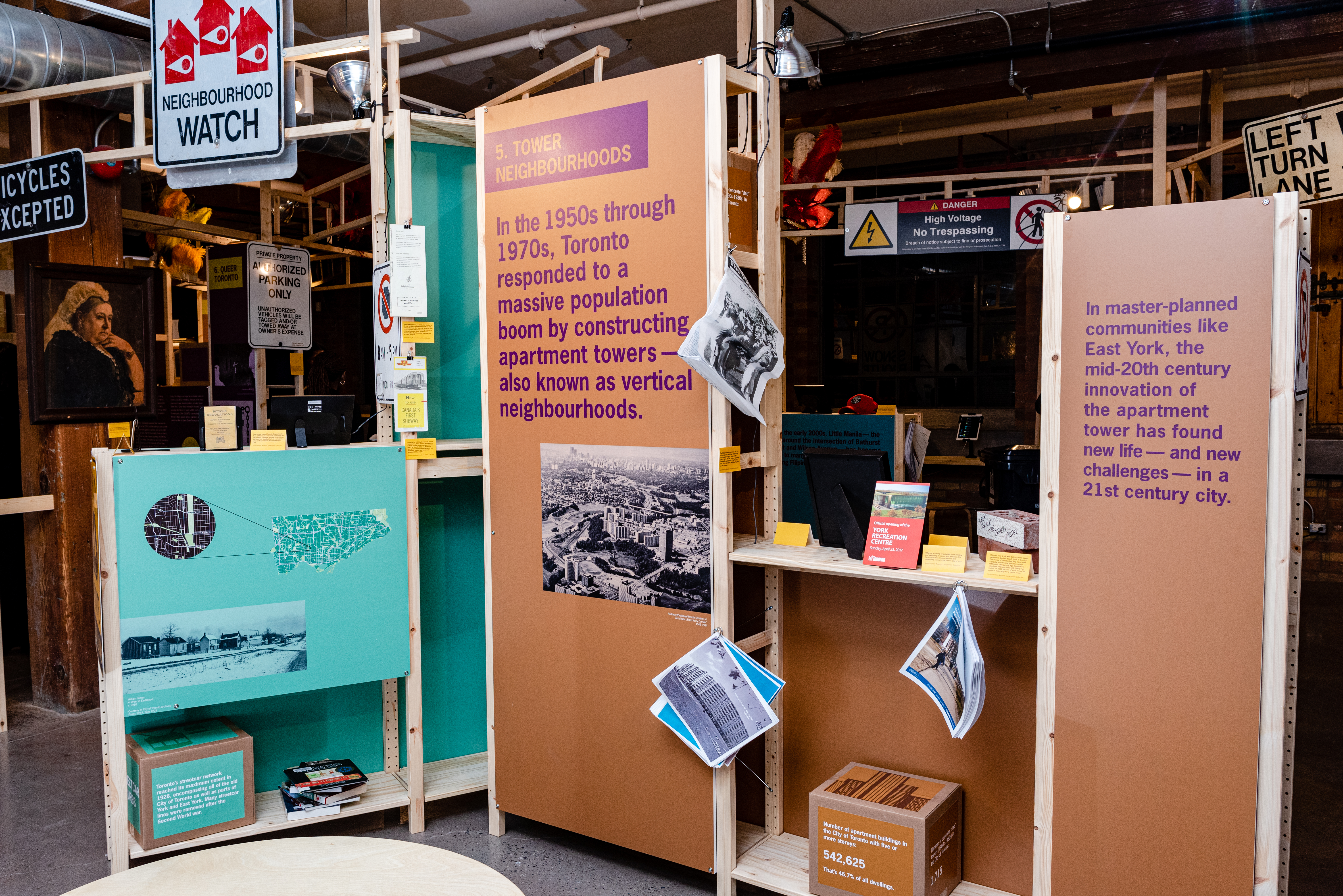
Number of apartments buildings in the City of Toronto with five or more storeys: 542,625. That’s 46.7% of all dwellings!
Number of concrete “slab” towers (1960s-1980s) in the City of Toronto: 1,715
Number of high-rise apartments that need serious repair (2021): 26,700
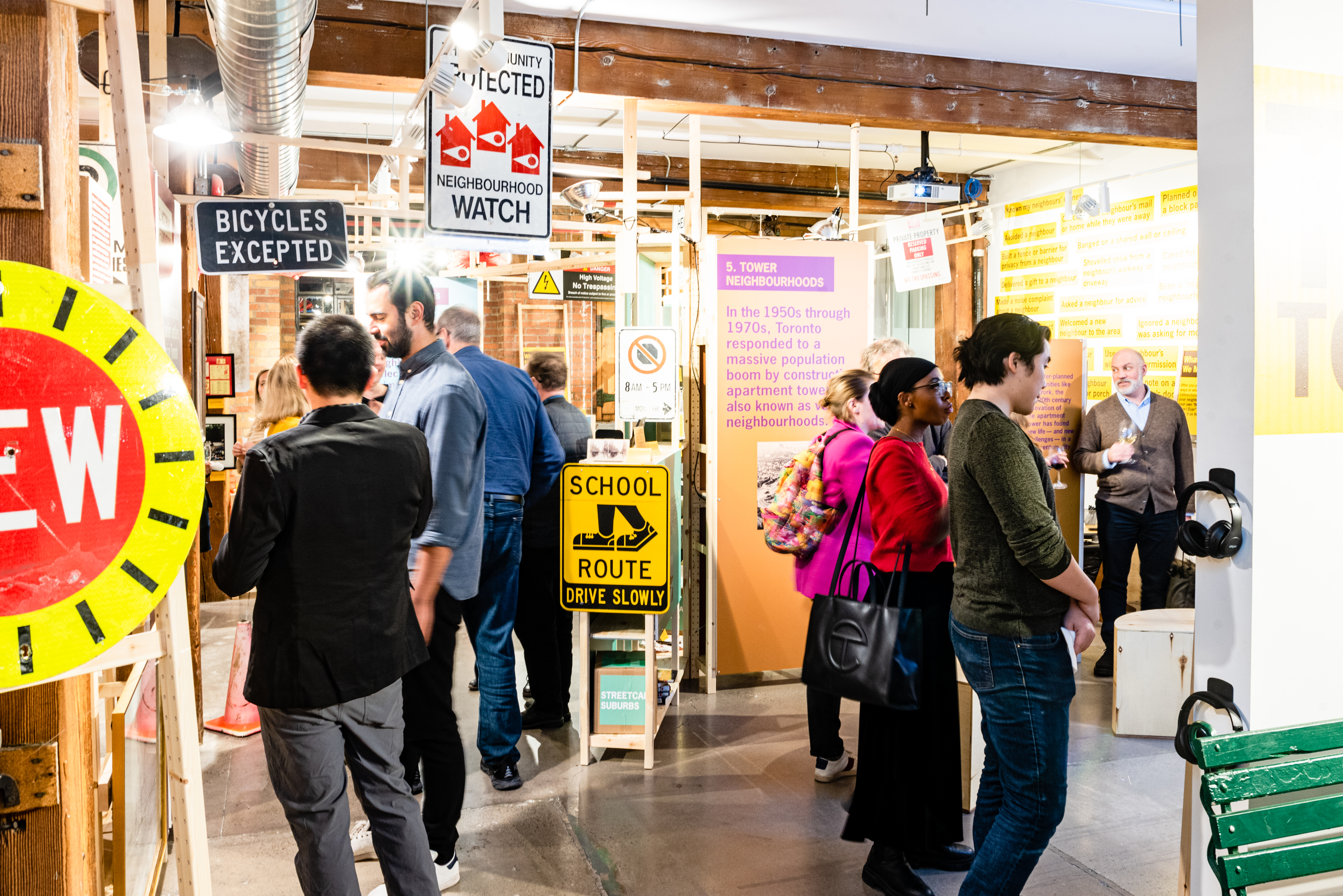
In the 1950s through 1970s, Toronto responded to a massive population boom by constructing apartment towers — also known as vertical neighbourhoods. In master–planned communities like East York, the mid-20th century innovation of the apartment tower has found new life — and new challenges — in a 21st century city.
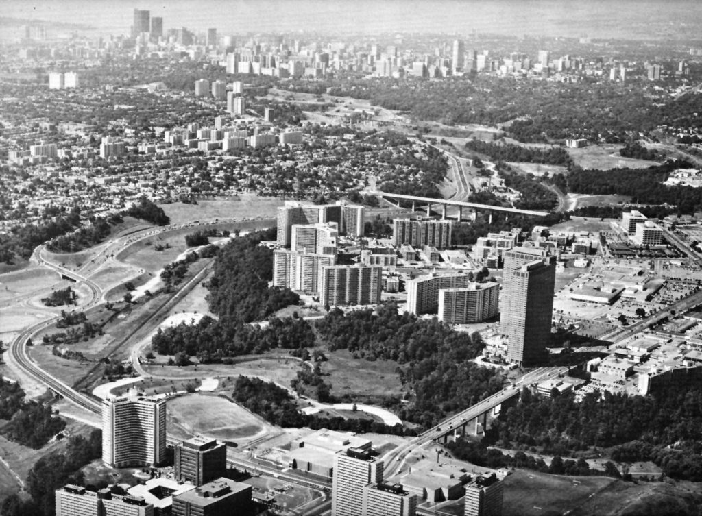
Following the Second World War, Toronto’s population surged with newcomers, and development moved northward. As in many North American cities at mid-century, urban planners considered new solutions for accommodating growth. In the Town of Leaside, later part of East York, planner Eugene Faludi spearheaded a plan in 1955 to redevelop a racetrack. This land became Thorncliffe Park, one of Canada’s first apartment tower neighbourhoods.
The master plan for Thorncliffe Park included clusters of low-, mid-, and high-rise buildings, intended to house 12,500 people. At the time, the area’s towers were internationally recognized as being modern and innovative, with a range of apartment configurations and amenities.
Today, Toronto’s tower neighbourhoods are more densely populated than intended, and many of the buildings require substantial rehabilitation, more than any other city in North America. Thorncliffe Park is home to mostly moderate-income families who are newcomers to Canada, including a sizeable Muslim population. Anchored by grassroots organizations and an active, multicultural community, Thorncliffe Park is a lively, entrepreneurial neighbourhood also in need of reinvestment.
Tower Neighbourhoods
Article
Tkaronto
Quick Facts
Toronto has the 4th-largest Indigenous population of any city in Canada.
35% of Toronto’s Indigenous community has experienced homelessness.
In 2022, City Council adopted a Reconciliation Action Plan with 28 calls-to-action.
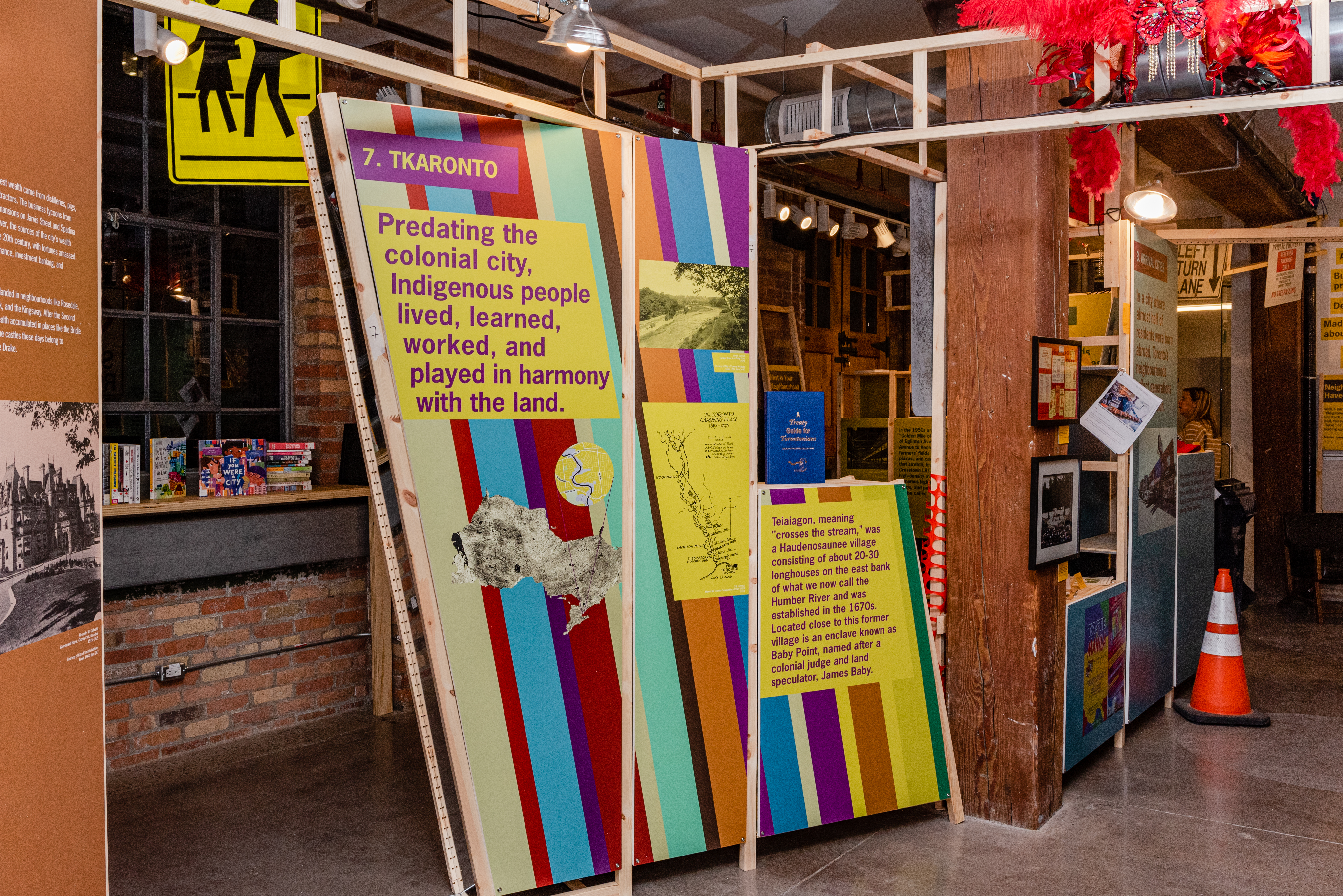
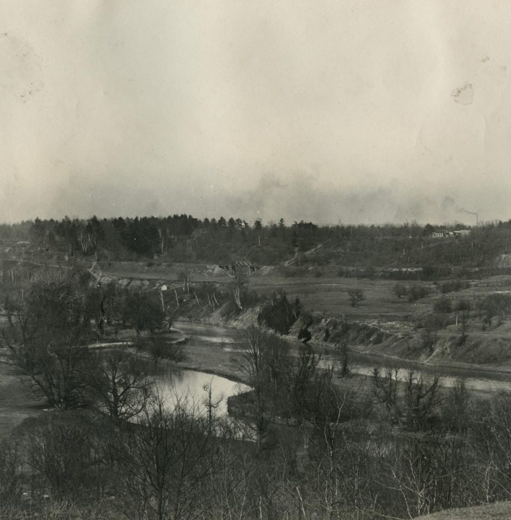
Predating the colonial city, Indigenous people lived, learned, worked, and played in harmony with the land. Teiaiagon, meaning “crosses the stream,” was a Haudenosaunee village consisting of about 20-30 longhouses on the east bank of what we now call the Humber River and was established in the 1670s. Located close to this former village and now known as Baby Point is an enclave named after James Baby, a colonial judge and land speculator.
Toronto gets its name from the passage of the Humber River referred to as Tkaronto. Several groups of Indigenous Peoples have lived on this land for at least 12,000 years including the Anishnaabeg, the Haudenosaunee, and Wendat. The region has a rich history of Indigenous settlement and transportation routes, including the Carrying Place Trail along the Humber River, and Gete-Onigaming, a portage following the glacial Lake Iroquois shoreline which is now known as Davenport Road.
Besides Teiaiagon, settlements existed along the Scarborough Bluffs near the Rouge River – among them, a community of 16 longhouses with artifacts dating to 1,400 CE. In North York’s St. Andrews-Windfields neighbourhood, archaeologists working with Six Nations excavated a Wendat ossuary in 1997 during construction on a soccer field near Leslie Street and Highway 401. The structure, a burial site, dates to 1280 CE.
During the colonial period, representatives of the British Crown negotiated the Toronto Purchase (1787-1805) with the Mississaugas of the Credit. Over a century later, the federal government signed the Williams Treaties (1923) with the Anishinaabe Chippewa of the Simcoe communities of Beausoleil, Georgina Island, and Rama, and the Anishinaabe Michi Saagiig of the north shore of Lake Ontario, including Alderville, Curve Lake, Hiawatha, and Scugog Island. Both highly contentious, these treaties have since been the subject of extensive contemporary legal activity to provide adequate compensation and recognition for the false surrender of vast tracts of land.
Currently, about 70,000 First Nations, Métis, and Inuit peoples live in Toronto and across the GTA, with core institutions such as the Native Canadian Centre, Anishnawbe Health and Kapapamahchakwew – Wandering Spirit School.
Tkaronto
Article
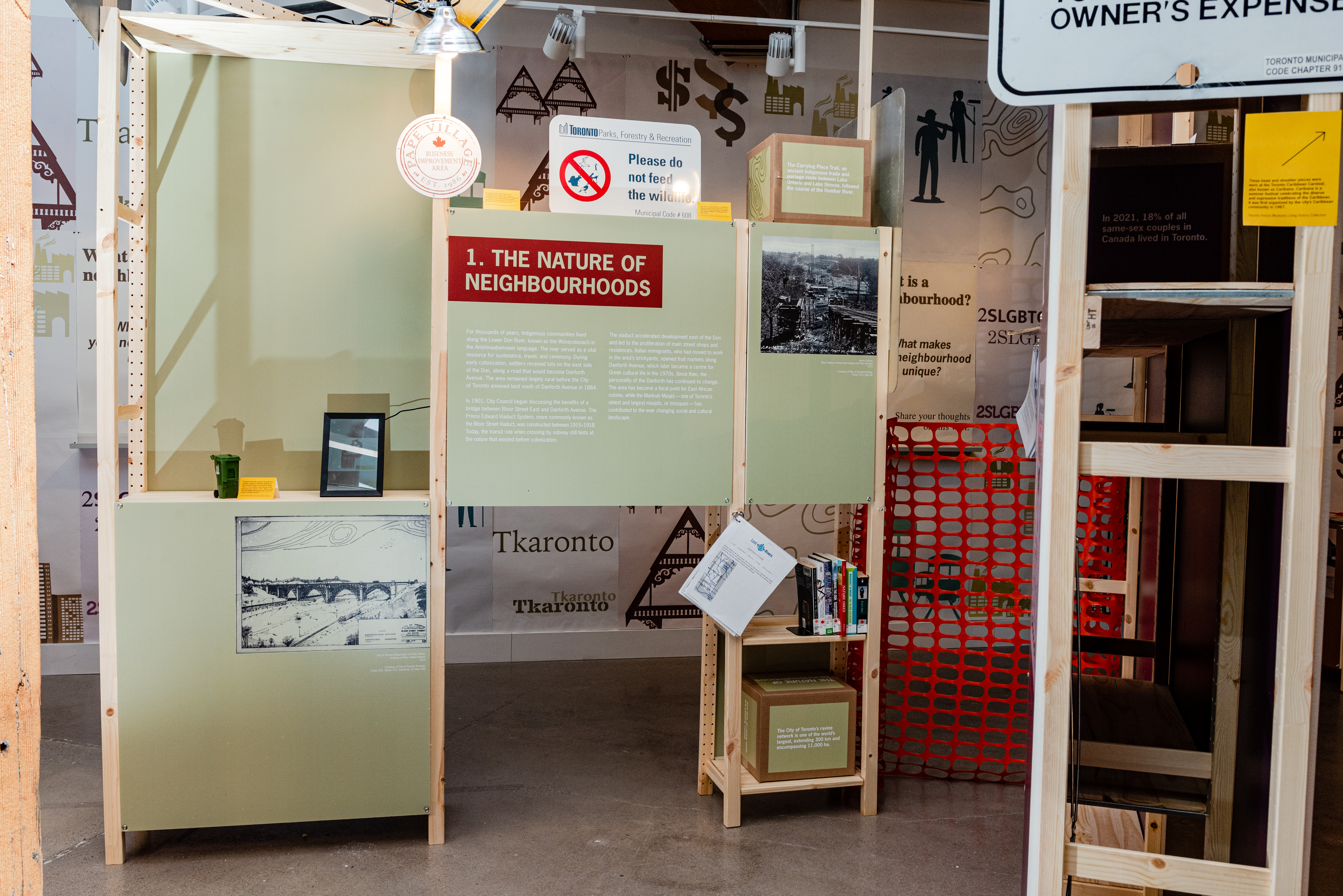
The Nature of Neighbourhoods
Quick Facts
The City of Toronto’s ravine network is one of the world’s largest, extending 300 km and encompassing 11,000 hectares.
Just 60% of ravine lands are publicly owned.
The Carrying Place Trail, an ancient Indigenous trade and portage route between Lake Ontario and Lake Simcoe, followed the course of the Humber River.
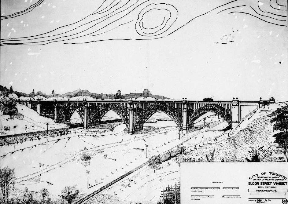
Toronto’s distinctive geographical features — rivers like the Humber and Don, lakefronts, and ravines —have shaped our neighbourhoods. Soaring over the Don Valley to connect both sides of the river valley, the Bloor Street Viaduct in 1918 hastened development of a thriving commercial main street and numerous residential neighbourhoods both north and south of Danforth Avenue.
For thousands of years, Indigenous communities lived along the Lower Don River, known as the Wonscotonach in the Anishinaabemowin language. The river served as a vital resource for sustenance, travel, and ceremony. During early colonization, settlers received lots on the east side of the Don, along a road that would become Danforth Avenue. The area remained largely rural before the City of Toronto annexed land south of Danforth Avenue in 1884.
In 1901, City Council began discussing the benefits of a bridge between Bloor Street East and Danforth Avenue. The Prince Edward Viaduct System, more commonly known as the Bloor Street Viaduct, was constructed between 1915–1918. Today, the transit ride when crossing by subway still hints at the nature that existed before colonization.
The viaduct accelerated development east of the Don and led to the proliferation of main street shops and residences. Italian immigrants, who had moved to work in the area’s brickyards, opened fruit markets along Danforth Avenue, which later became a centre for Greek cultural life in the 1970s. Since then, the personality of the Danforth has continued to change. The area has become a focal point for East African cuisine, while the Madinah Masjid, one of Toronto’s oldest and largest Masajids (or mosques), has contributed to the ever changing social and cultural landscape.
The Nature of Neighbourhoods
Article
Streetcar Suburbs
Quick Facts
The City established the TTC in 1921 in response to complaints over poor service and accidents on the Toronto Railway Company’s privately-run streetcar network.
Toronto’s streetcar network reached its maximum extent in 1928, encompassing all of the old City of Toronto as well as parts of York and East York. Many streetcar lines were removed after the Second World war.
After the Second World War, the TTC maintained its streetcar operation in part by acquiring out-of-service streetcars from U.S. cities that had discontinued their own networks, such as Philadelphia, Birmingham, and Kansas City.
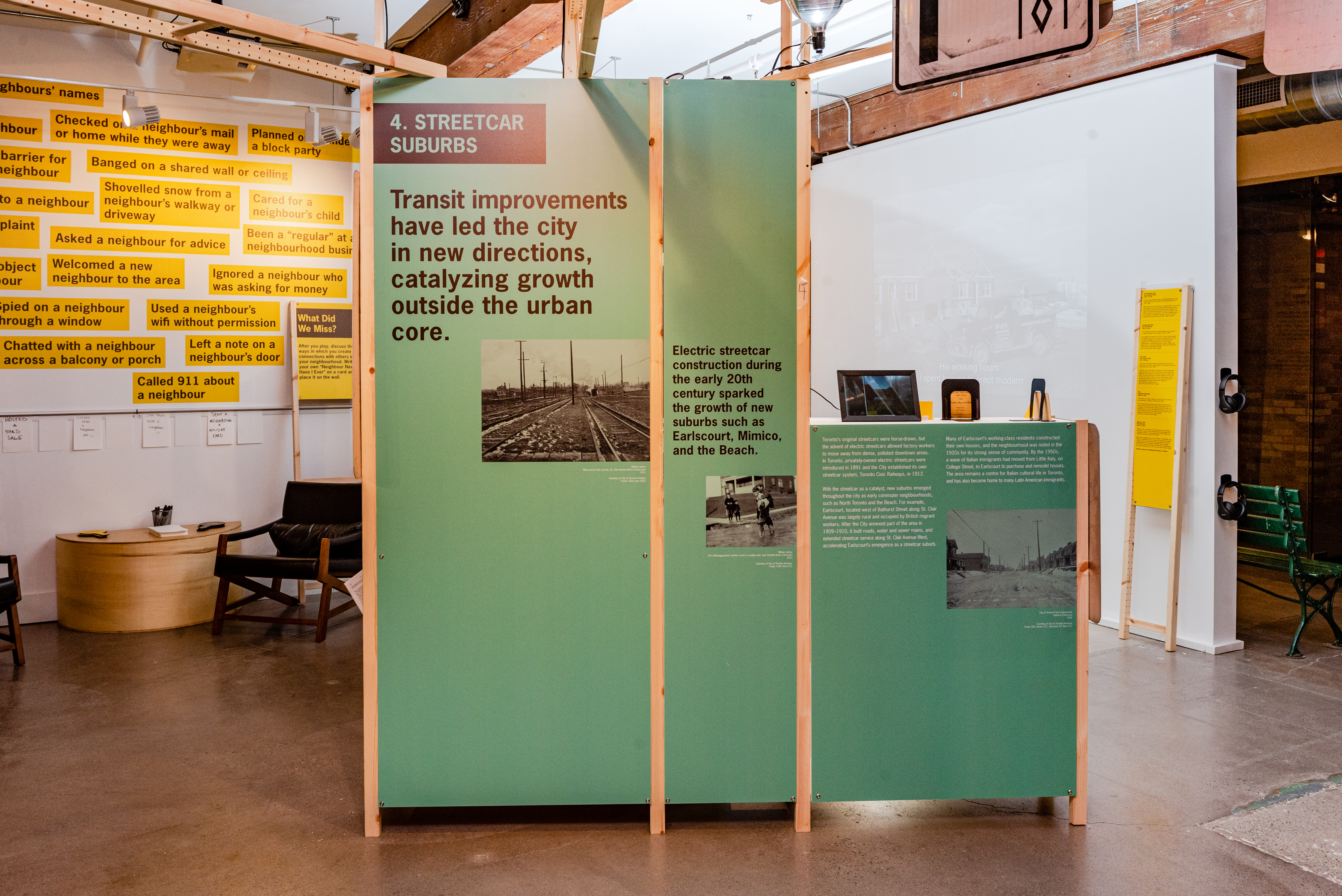
Transit improvements have led the city in new directions, catalyzing growth outside the urban core. Electric streetcar construction during the early 20th century sparked the growth of new suburbs such as Earlscourt, Mimico, and the Beach.
Toronto’s original streetcars were horse-drawn, but the advent of electric streetcars allowed factory workers to move away from dense, polluted downtown areas. In Toronto, privately owned electric streetcars were introduced in 1891 and the City established its own streetcar system, Toronto Civic Railways, in 1912.
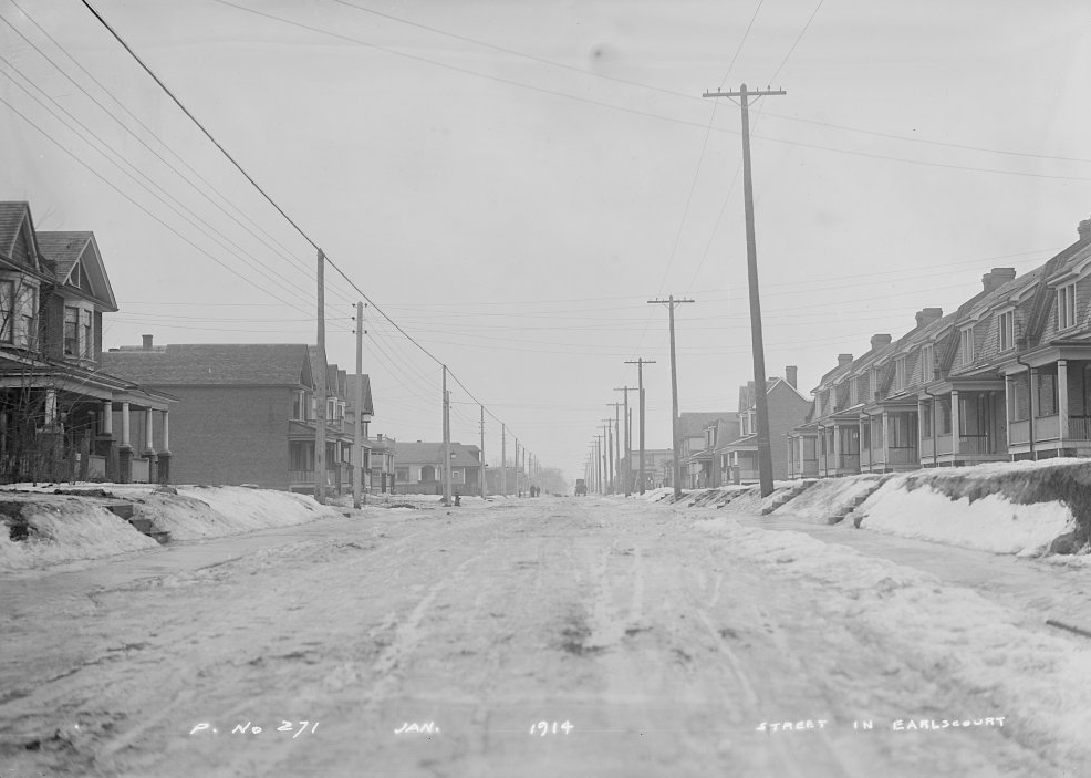
With the streetcar as a catalyst, new suburbs emerged throughout the city as early commuter neighbourhoods, such as North Toronto and the Beach. For example, Earlscourt, located west of Bathurst Street along St. Clair Avenue was largely rural and occupied by British migrant workers. After the City annexed part of the area in 1909–1910, it built roads, water and sewer mains, and extended streetcar service along St. Clair West, accelerating Earlscourt’s emergence as a streetcar suburb.
Many of Earlscourt’s working class residents constructed their own houses, and the neighbourhood was noted in the 1920s for its strong sense of community. By the 1950s, a wave of Italian immigrants had moved from Little Italy, on College, to Earlscourt to purchase and remodel houses. The area remains a centre for Italian cultural life in Toronto, and has also become home to many Latin American immigrants.
Streetcar Suburbs
Article
Queer Toronto
Quick Facts
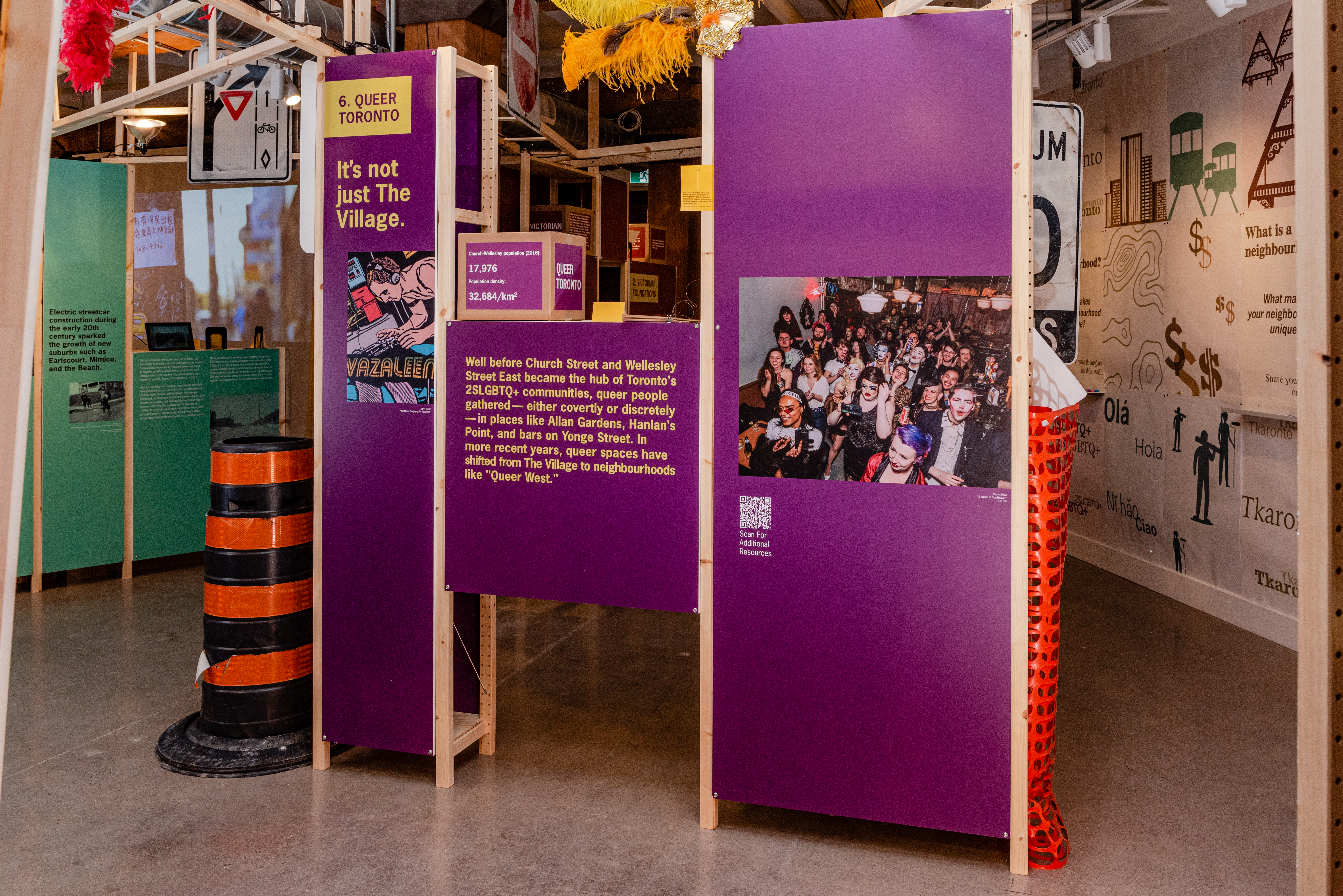
Church-Wellesley population (2016): 17,976
Population density: 32,684/ km2
An estimated 1.6 million people turned out to Toronto’s Pride Parade in 2022.
In 2021, 18% of all same-sex couples in Canada lived in Toronto.
It’s not just The Village. Well before Church Street and Wellesley Street East became the hub of Toronto’s 2SLGBTQ+ communities, queer people gathered — either covertly or discretely — in places like Allan Gardens, Hanlan’s Point, and bars on Yonge Street. In more recent years, queer spaces have shifted from The Village to neighbourhoods like “Queer West.”
Toronto’s puritanical attitudes towards sex, drinking, gambling, prostitution, and socialism left its mark on neighbourhoods. For 2SLGBTQ+ people, stigmatization drove them to congregate in secret. By the 1960s, queer spaces like the St. Charles Tavern on Yonge Street were well established, but also subject to homophobia and police spying.
2SLGBTQ+ Torontonians advanced their movement for civil rights in the 1970s, but their advocacy was met with harassment and aggressive policing, such as the 1981 bathhouse raids. The 519 Community Centre on Church Street became a hub of queer organizing and the focal point of The Village. The election of queer city councillors, HIV/AIDS activism, and the popularity of Pride Week improved relationships between 2SLGBTQ+ communities and local institutions.
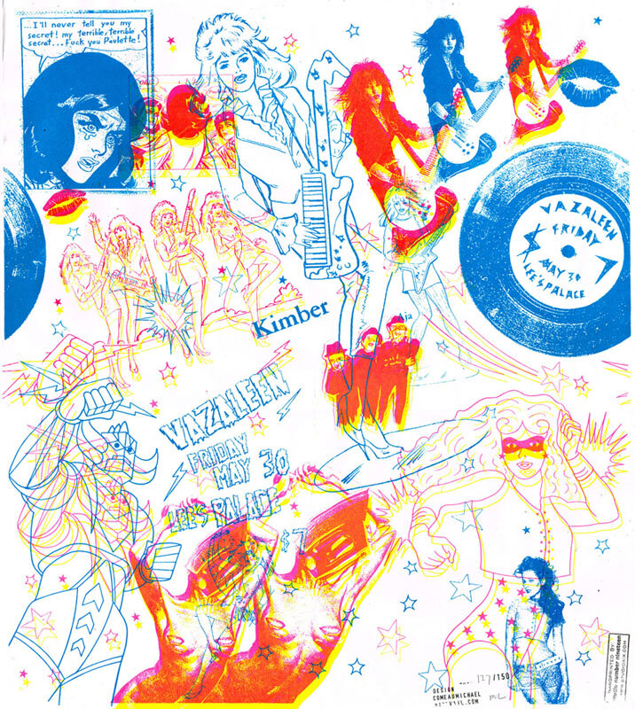
Today, The Village is no longer the residential centre for Toronto’s 2SLGBTQ+ residents, and many of the city’s queer events have moved elsewhere, including Queen Street West. “Queer West” emerged in the early 2000s, providing alternatives for queer nightlife, such as the Vazaleen party. Other 2SLGBTQ+ communities have formed in digital spaces, homes, collectives, and pop-up parties like New Ho Queen. Queer Toronto is everywhere.
Queer Toronto
Article
Pluggy Satchmo
This is Pluggy Satchmo. If you don’t recognize his name, you might recognize him from Little Jamaica’s famous mural.
Pluggy Satchmo
Video
• :59
New Toronto
Did you know that New Toronto was once a self-sufficient factory town built to rival old Toronto as an industrial powerhouse?
New Toronto
Video
• 1:12
New Coin Laundry
Today, you might recognize this Victorian home as St Jamestown’s New World Coin Laundry.
New Coin Laundry
Video
• :57
Naaz Theatre
Did you know Toronto’s Little India began with a Bollywood movie theatre? In 1972, Gian Naaz transformed an abandoned cinema on Gerrard Street into the Naaz Theatre, the first South Asian movie theatre in Canada.
Naaz Theatre
Video
• 1:06
Money
Quick Facts
10,000 protesters marched on April 15, 1872, during a printers’ strike calling for an eight-hour work day; the Federal Government legalized trade unions three days later. In the years following, the labour movement grew, leading to Canada’s first official Labour Day holiday in 1894.
Today, the Toronto & York Region Labour Council represents 220,000 unionized workers across the GTA.
The City of Toronto has a “Fair Wage Policy” that dates back to 1893. It requires the municipality to ensure that its contractors paid their employees union rates.
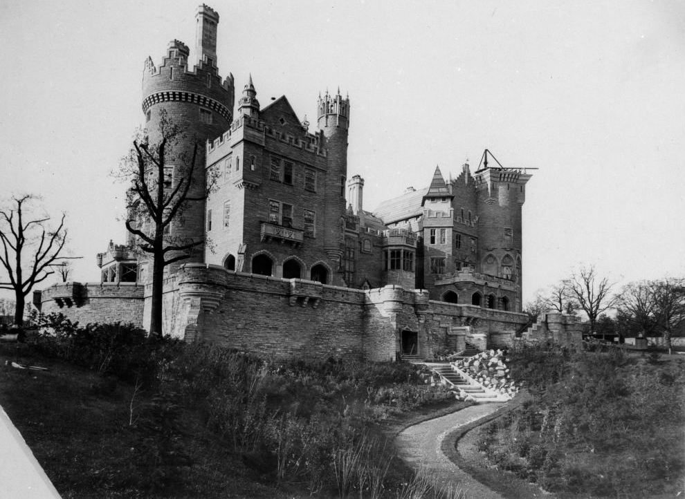
In Toronto’s monied neighbourhoods, industries created castles of cash. Wells Hill, near Spadina Avenue and St. Clair Avenue West, has its own faux castle — the storied Casa Loma, built in 1914 by the mining and electricity magnate Henry Pellatt.
In the late 1800s, before Toronto had monied neighbourhoods, wealthy businessmen built mansions along the escarpment north of Davenport Road. They were owned by merchants, real estate speculators, bankers, and even a piano maker. One, Henry Pellatt, made a fortune in cobalt mining and turned his capital into Casa Loma — Toronto’s postcard castle.
The area, originally known as the Hill District, acquired neighbourhood names like Wells Hill, South Hill, and Forest Hill. It was subdivided and marketed to affluent buyers who wanted to live in stately homes.
Toronto’s earliest wealth came from distilleries, pigs, railways, and tractors. The business tycoons from that era built mansions on Jarvis Street and Spadina Avenue. However, the sources of the city’s wealth changed in the 20th century, with fortunes amassed from mining finance, investment banking, and newspapers.
Those profits landed in neighbourhoods like Rosedale, Lawrence Park, and the Kingsway. After the Second World War, wealth accumulated in places like the Bridle Path, where the castles these days belong to celebrities like Drake.
Money
Article
Factories
Quick Facts
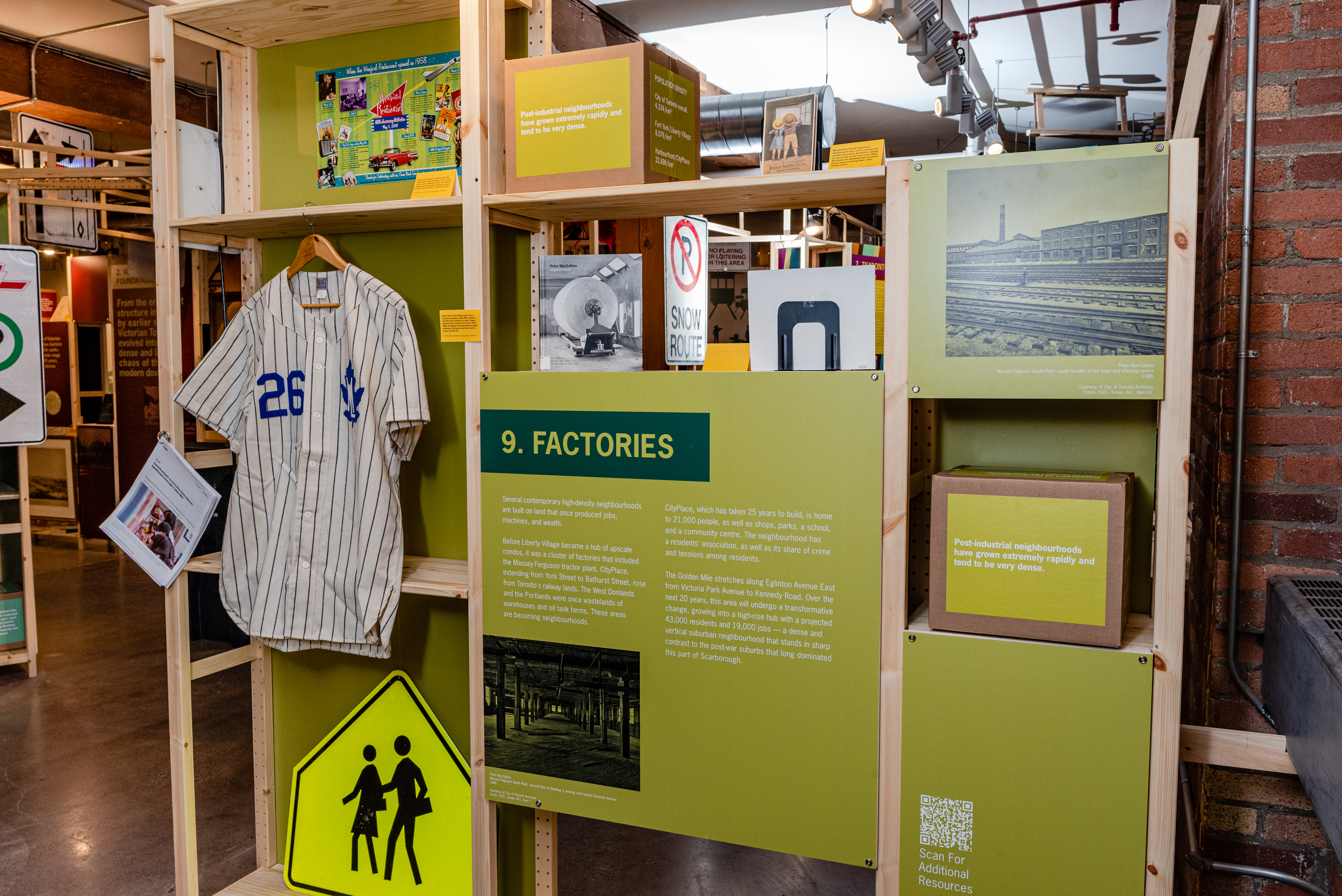
Post-industrial neighbourhoods have grown extremely rapidly and tend to be very dense.
Fort York/Liberty Village (2016), the former Massey-Ferguson lands: 17,445.
That’s an 88% population increase 2011-2016.
Harbourfront / CityPlace (2016), former railway lands: 25,422.
That’s a 53% population increase from 2011-2016.
Population Density
City of Toronto overall: 4,334 km2
Fort York/Liberty Village: 8,076 km2
Harbourfront/CityPlace: 22,698 km2
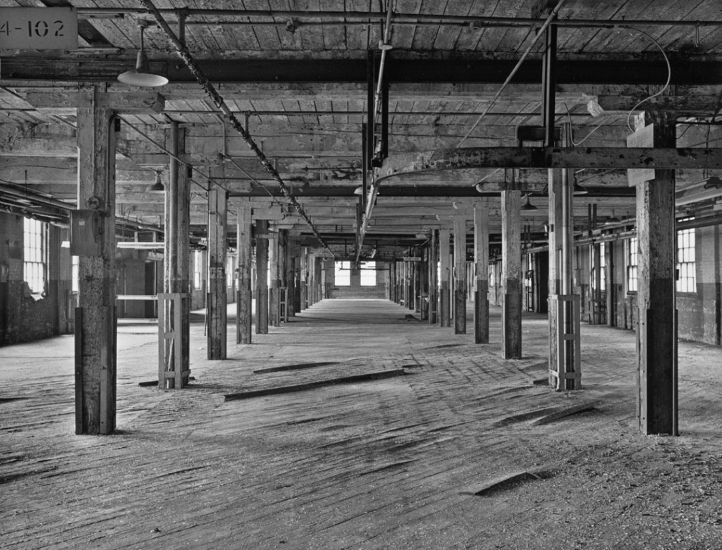
Several contemporary high-density neighbourhoods are built on land that once produced jobs, machines, and wealth. Before Liberty Village became a hub of upscale condos, it was a cluster of factories that included the Massey-Ferguson tractor plant. CityPlace, extending from York Street to Bathurst Street, rose from Toronto’s railway lands. The West Donlands and the Portlands were once wastelands of warehouses and oil tank farms. These areas are becoming neighbourhoods.
CityPlace, which has taken 25 years to build, is home to 21,000 people, as well as shops, parks, a school, and a community centre. The neighbourhood has a residents’ association, as well as its share of crime and tensions among residents.
The Golden Mile stretches along Eglinton Avenue East from Victoria Park Avenue to Kennedy Road. Over the next 20 years, this area will undergo a transformative change, growing into a high-rise hub with a projected 43,000 residents and 19,000 jobs — a dense and vertical suburban neighbourhood that stands in sharp contrast to the post-war suburbs that long dominated this part of Scarborough.
In the 1950s and 1960s, Scarborough’s “Golden Mile of Industry” — the stretch of Eglinton Avenue from Victoria Park Avenue to Kennedy Road — transformed farmers’ fields into sprawling factories, plazas and car dealerships. Today, that stretch, bisected by the Eglinton Crosstown LRT, is turning into a high-density mixed-use community with numerous high-rise apartment complexes, shops and parks. The neighbourhood will be called “The Golden Mile.”
How high density neighbourhoods replaced factories, plazas, and car dealerships.
Factories
Article
Extinct Passenger Pigeons
Did you know Mimico means “resting place of the wild pigeon”? Long before condos lined the lake, Mimico was named for the vast flocks of passenger pigeons that once filled the skies over Toronto, so many that their migration darkened the horizon and sounded like thunder.
Extinct Passenger Pigeons
Video
• 1:06
Cabbagetown
Toronto’s Cabbagetown neighbourhood can trace its name to a derogatory epithet coined by the wealthy British residents of the city in the 19th century.
Cabbagetown
Video
• :57
Arrival Cities
Quick Facts
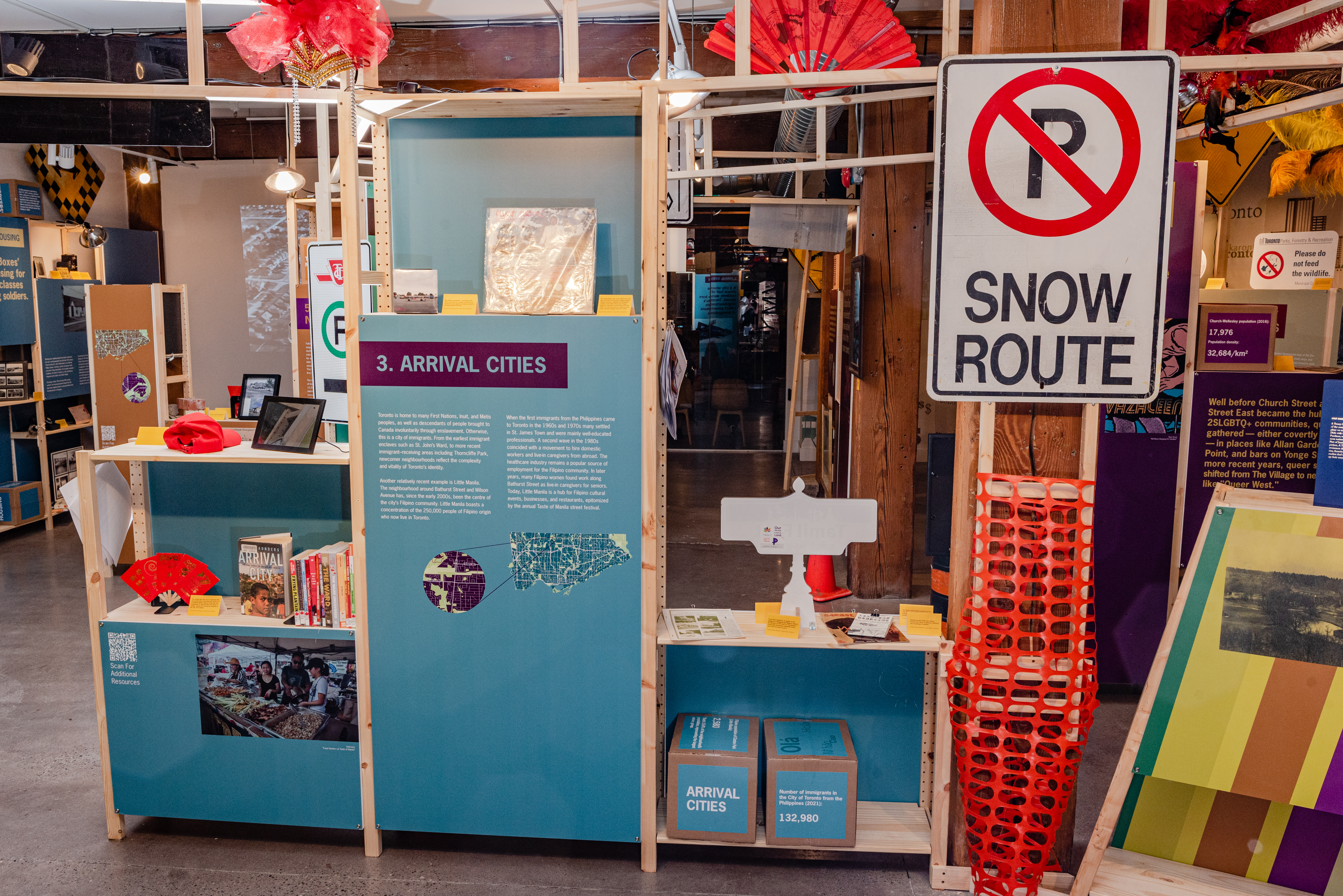
Number of immigrants in the City of Toronto (2021): 1,286,140. That’s 46.6% of Toronto’s population.
Number of immigrants in the City of Toronto from the Philippines (2021): 132,980.
Filipino population of Clanton Park (Little Manila): 2,580. That’s 15.6% of the neighbourhood’s population, representing the largest ethnic group.
In a city where almost half of residents were born abroad, Toronto’s neighbourhoods reflect generations of immigration.
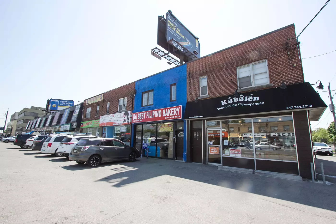
Since the early 2000s, Little Manila — the area around the intersection of Bathurst Street and Wilson Avenue — has become home to many newcomers within Toronto’s growing Filipino population.
Toronto is home to many First Nations, Inuit, and Métis peoples, as well as descendants of people brought to Canada involuntarily through enslavement. Otherwise, this is a city of immigrants. From the earliest immigrant enclaves such as St. John’s Ward, to more recent immigrant–receiving areas including Thorncliffe Park, newcomer neighbourhoods reflect the complexity and vitality of Toronto’s identity.
Another relatively recent example is Little Manila. The neighbourhood around Bathurst Street and Wilson Avenue has, since the early 2000s, been the centre of the city’s Filipino community. Little Manila boasts a concentration of the 250,000 people of Filipino origin who now live in Toronto.
When the first immigrants from the Philippines came to Toronto in the 1960s and 1970s many settled in St. James Town and were mainly well-educated professionals. A second wave in the 1980s coincided with a movement to hire domestic workers and live-in caregivers from abroad.
The healthcare industry remains a popular source of employment for the Filipino community. In later years, many Filipino women found work along Bathurst Street as live-in caregivers for seniors. Today, Little Manila is a hub for Filipino cultural events, businesses and restaurants, epitomized by the annual Taste of Manila street festival.
Arrival Cities
Article
More About the Project
Ten of Toronto was co-curated by Tatum Taylor Chaubal and John Lorinc with exhibition design by elsonstudio, and Erik Skouris and Matthew Hickey of Two Row Architect.
Special thanks to: Matt Abbott, Tyler Andrews, Cheryl Blackman, Francesca Bouaoun, Roland Gulliver, Linda Hazzan, Gabrielle Major, Dr. Ronald F. Williamson, Lisa Radha Vohra, and to Archaeological Services Inc, City of Toronto Archives, City of Toronto Museums & Heritage Services, East End Arts, National Film Board of Canada, Toronto International Festival of Authors, and the Toronto Public Library.
Ten of Toronto was conceptualised and organized by the Museum of Toronto team. We are Kamran Dadi, Bria Dietrich, Nadine Villasin Feldman, Breanne Gimza, April Hazan, Davin Henson, Kathleen Lew, Natasha Mirosavljevic, Heidi Reitmaier, Rosemary Snell, Julie Suh, and Sarah Tumaliuan.
Museum of Toronto is made possible with the generous support of Diane Blake and Stephen Smith.